Atmosphären- Physik Marc Wüest IACETH
1
Atmosph
Atmosphä ärenphysik: renphysik: Precipitation Precipitation Processes
Processes
Ulrike Lohmann und Marc Wüest Institut für Atmosphäre und Klima IACETH
ETHZ CHN
www.iac.ethz.ch/people/ulohmann www.iac.ethz.ch/people/wueest
in Anlehnung and Rogers and Yau, Kapitel 12
Atmosphären- Physik Marc Wüest IACETH
2
Cyclone Cyclone
Atmosphären- Physik
Precipitation processes Precipitation processes
• The spatial extent, intensity and lifetime of a precipitation system are mainly controlled by vertical air motions. To a large extent, these air motions are the manifestation of the different types of atmospheric instabilities described earlier.
• Characteristic time and length scales depend on:
– D, the depth of the unstable layer (D< 10 km) – N, the Brunt-Väisälä frequency (N~ 10-2s-1) – f, the Coriolis parameter (f~ 10-4s-1at midlatitudes) – β= df/dy, the meridional gradient of f(β~10-11m-1s-1) – du/dz, the wind shear du/dz~ 2 x 10⁻³s-1)
Atmosphären- Physik Marc Wüest IACETH
4
Precipitation processes Precipitation processes
• applying scale analyses leads to following estimates for the characteristic horizontal and temporal scale of motions associated with the different kinds of instability:
Atmosphären- Physik Marc Wüest IACETH
5
Precipitation processes Precipitation processes
• Baroclinicinstability accounts for precipitation systems on the synoptic scale. The vertical motion is widespread and in order of cm/s. Conditionalinstability produces cumulus convection with localized updrafts of several m/s.
Symmetricinstability can account for mesoscale systems with updraft speed between those for convective and synoptic scale systems.
• The close relation between the scale and intensity of vertical motions and the character of the precipitation they produce leads to following precipitation classification:
1. Widespread, stratiform, continuous precipitation associated with large scale ascent produced by frontal or topographic lifting of large scale horizontal convergence.
2. Localized, convective, showery precipitation associated with cumulus-scale convection in unstable air.
Atmosphären- Physik Marc Wüest IACETH
6
Precipitation processes Precipitation processes
• This is a useful classification, although the distinction between stratiform and convective precipitation is not always sharp. Widespread precipitation, when observed either by radar or rain gauge, invariably shows fine-scale structure with the most intense precipitation confined to elements with a size of only several km. Conversely, convective
precipitation can extend over a large area and produce a pattern similar to that of continuous precipitation. We classify as convection, if locally intense regionsrange in size from 1 to 10 km and are separatedfrom one another by areas free of precipitation. Moreover, the pattern of stratiformprecipitation evolves relatively slowlyin time, and that of convective precipitation changes rapidly.
• Stratiform rain is produced in nimbostratus clouds, although dissipating cumulus clouds and orographic clouds may contain rain with stratiform structure. Most snow originates in Ns (nimbostratus), but snow flurries and graupel showers can be produced in convective clouds.
Atmosphären- Physik Marc Wüest IACETH
7
Observations of stratiform Observations of stratiform precipitation
precipitation
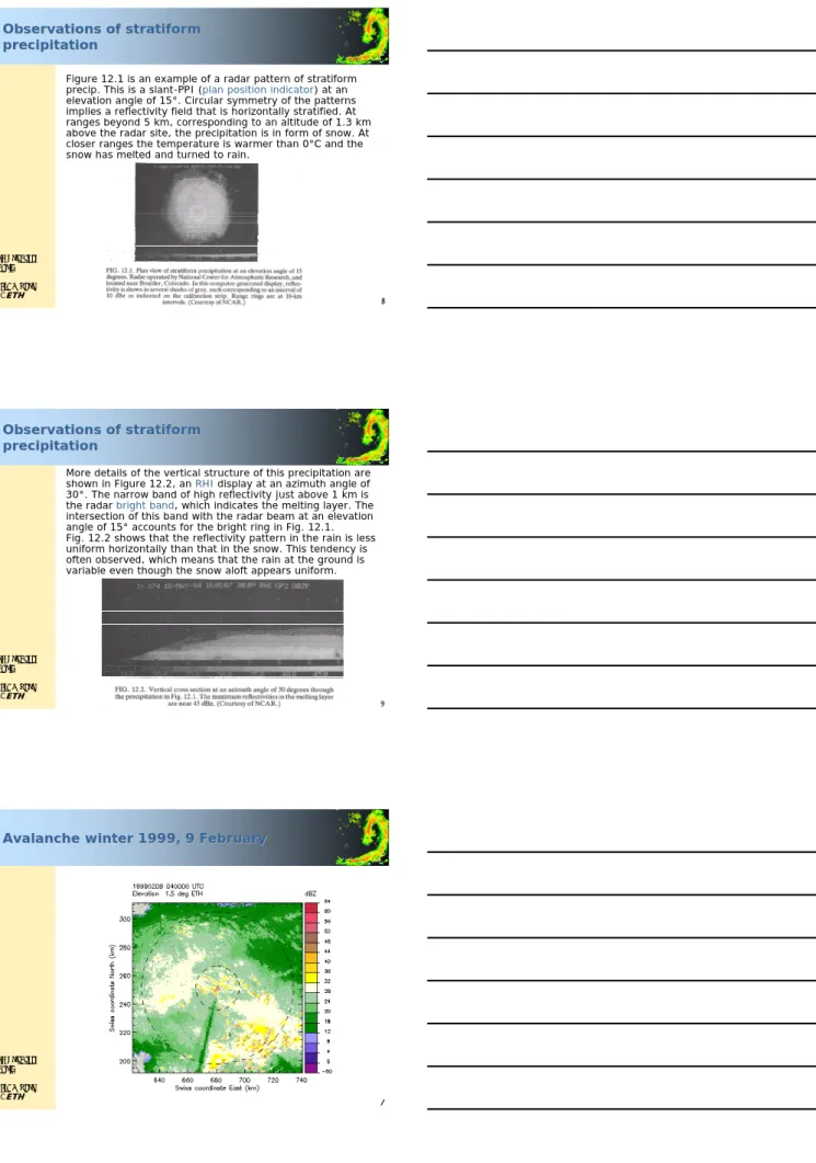
Figure 12.1 is an example of a radar pattern of stratiform precip. This is a slant-PPI (plan position indicator) at an elevation angle of 15°. Circular symmetry of the patterns implies a reflectivity field that is horizontally stratified. At ranges beyond 5 km, corresponding to an altitude of 1.3 km above the radar site, the precipitation is in form of snow. At closer ranges the temperature is warmer than 0°C and the snow has melted and turned to rain.
Atmosphären- Physik Marc Wüest IACETH
8
Observations of stratiform Observations of stratiform precipitation
precipitation
More details of the vertical structure of this precipitation are shown in Figure 12.2, an RHIdisplay at an azimuth angle of 30°. The narrow band of high reflectivity just above 1 km is the radar bright band, which indicates the melting layer. The intersection of this band with the radar beam at an elevation angle of 15° accounts for the bright ring in Fig. 12.1.
Fig. 12.2 shows that the reflectivity pattern in the rain is less uniform horizontally than that in the snow. This tendency is often observed, which means that the rain at the ground is variable even though the snow aloft appears uniform.
Atmosphären- Physik
Avalanche winter 1999, 9 February
Avalanche winter 1999, 9 February
Atmosphären- Physik Marc Wüest IACETH
10
Observations of stratiform Observations of stratiform precipitation
precipitation
Fig 12.3 shows another example of the bright bandtogether with a vertical profile typical for a melting layer. The melting layer is several hundred meters thick. The reflectivity maximum can exceed by 10 dBZ the reflectivities in the rain below or the snow above.
Atmosphären- Physik Marc Wüest IACETH
11
Observations of stratiform Observations of stratiform precipitation
precipitation
• The Doppler velocity increases from 1.5 m/s for snow to 6 m/s for rain, with the maximum gradient velocity located just below the level of maximum reflectivity. As snowflakes descend into air warmer 0°C, their radar reflectivity increases for several reasons, the most important of which is melting, because the dielectric constantof water exceeds that of ice by a factor of 4.4 or 6.5 dB. Also, in its initial stages, melting produces distorted snowflakeswith somewhat higher reflectivities than those of spherical drops of the same mass.
Continuing to melt while descending, the snowflakes become more compact and finally collapse into raindrops.
Since the raindrops fall faster than the snowflakes their concentration in space is reduced. The dilutionof the numbers accounts in part for the decrease in reflectivity in the lower part of the melting layer. If melting flakes break apartfurther reduction in reflectivity occurs.
Atmosphären- Physik Marc Wüest IACETH
12
Observations of stratiform Observations of stratiform precipitation
precipitation
Estimated changes in reflectivity in the bright band due to different effects (Wexler, 1955):
The fact that observations often reveal a stronger bright band than predicted suggests that aggregationin the upper part of the melting layer and disintegration below are occurring.
The bright band in stratiform precipitation is weak, diffuse or entirely absent if convective overturning disrupts the stratification necessary for a well defined bright band.
Atmosphären- Physik Marc Wüest IACETH
13
11 September 2003
11 September 2003 over over Germany Germany
Atmosphären- Physik Marc Wüest IACETH
14
Observations of stratiform Observations of stratiform precipitation
precipitation
Convection in widespread precipitation manifests itself in so-called snow generating cells.
Fig 12.4 shows radar images of widespread snow from a vertically pointing radar, i.e.
snow as a function of time and altitude (HTI). Pattern of type (a) and (d) are observed in advance of snow reaching the ground; most snowfall is associated with a trail pattern as in (b). These trails originate in compact cells called generating cellswhich are smaller than the trails and often not actually observed. Stalactitesas in (d) indicate that snow falls into dry air. Sublimation of snow chills the air, causing local overturning that perturbs the lower echo boundary.
Atmosphären- Physik
Observations of stratiform Observations of stratiform precipitation
precipitation
• Snow generating cellsare found to have no preferred altitude or temperature, but to be located usually just above frontal surfaces in air that is hydrostatically stable.
From the slope of snow trails and knowledge of the speed of motion of the pattern though the beam, Marshall (1953) determined that the snow falls at about 1 m/s, which is consistent with the fall speed of aggregated snowflakes.
• Douglas and Marshall (1954) showed that latent heat of sublimation is sufficient to initiate convective overturning, and that the vertical development of these convective elements is comparable to the observed dimensions of generating cells.
• Consequently the generating cells are probably regions in which ice crystal growth by aggregation and accretion is promoted by sublimation-induced convection.
Atmosphären- Physik Marc Wüest IACETH
16
Observations of showers Observations of showers
The next figure is an example of a radar pattern of showers.
Some of the showers are aligned in line, often they don’t seem to. Individual echoes in patterns of this sort have lifetimes of less than an hour, and the patterns themselves evolve rapidly. Convection instead of gravitational settling dominates the precipitation growth process.
Monday 13 June 2005 graupel/hail in Zürich (PPI)
Atmosphären- Physik Marc Wüest IACETH
17
Observations of showers Observations of showers
Figures 12.7 show intensity and velocity patterns of a shower of 18 min duration from a vertically pointing radar (HTI). Rainfall during this time was 3.8 mm. Two convective active elements can be seen, each having a fairly continuous updraft and an associated region of high reflectivity. Multi-cellular showers are most common. However, one problem is, that one cannot determine whether the core of the shower or a fringe area is passing over!
Atmosphären- Physik Marc Wüest IACETH
18
Observations of showers Observations of showers
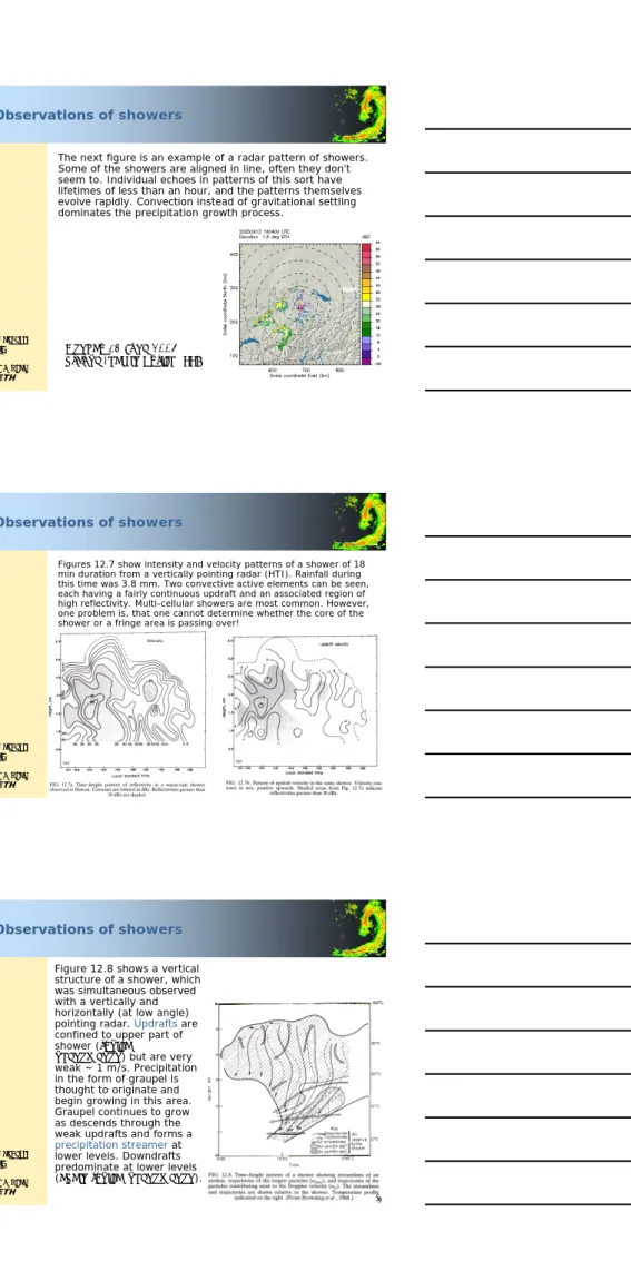
Figure 12.8 shows a vertical structure of a shower, which was simultaneous observed with a vertically and horizontally (at low angle) pointing radar. Updraftsare confined to upper part of shower (typical
phenomenon) but are very weak ~ 1 m/s. Precipitation in the form of graupel is thought to originate and begin growing in this area.
Graupel continues to grow as descends through the weak updrafts and forms a precipitation streamerat lower levels. Downdrafts predominate at lower levels (again typical phenomenon).
Atmosphären- Physik Marc Wüest IACETH
19
Observations of showers Observations of showers
• This rather characteristic pattern - updrafts at high levels and downdrafts below - suggests that the initial ascent of the air from low levels takes place outside any existing precipitation and is completed by the time the cloud particles in the ascending air have grown to radar detectable size.
• The lifetime of the convective element is thus about the same as the time required for the precipitation to develop.
Atmosphären- Physik Marc Wüest IACETH
20
Precipitation theories: stratiform Precipitation theories: stratiform
– Vertical wind < ~ 1 m/s – Horizontal scale ~ 100 km – Stable stratification
– external lifting through e.g. fronts, orography – in polar regions and winter in midlatitudes
Atmosphären- Physik
Precipitation theories: stratiform Precipitation theories: stratiform
• stratiform is vertical air motion w< Vice, where Vice represents scale of terminal velocity of snow (~ 1-3 m/s).
wmust be large enough to maintain supersaturation, it must be small enough to satisfy above criterion.
• The ice particles (IP) in the upper levels of Ns must fall;
they cannot be suspended or carried aloft by air motion as they grow.
• Time available for growth of IP from cloud top is 1-3 hours (the time is takes an IP falling at 1-3 m/s to descend 10 km). This time is sufficient for IP to grow by deposition.
Atmosphären- Physik Marc Wüest IACETH
22
Precipitation theories: stratiform Precipitation theories: stratiform
• When IP falling and growing by deposition descend to within 2.5 km of the 0°C level, aggregation and riming can occur.
• Most importantly, the IP begin to aggregateand form large, irregularly shaped snowflakes
• The IP may also grow by riming, since at these warmer levels the vertical air motions of a few tens of cm/s are sometimes strong enough to maintain a few CD in the presence of falling IP.
• Aggregation becomes more frequent within 1 km of the 0°C level. It doesn't add mass to precipitation, but rather concentrates the condensate into large particles, which, upon melting, become large, rapidly falling RD.
Atmosphären- Physik Marc Wüest IACETH
23
7 November 2002 7 November 2002
Atmosphären- Physik Marc Wüest IACETH
24
Precipitation theories: stratiform Precipitation theories: stratiform
• Precipitation from midlatitude stratiform clouds develops mainly by the ice-crystal process. These clouds have relatively low liquid water content (LWC), so coalescence is likely to be ineffective. Also these clouds normally last long and at -15°C the Bergeron process is very effective.
• In a survey of precipitation development, Braham (1968) found that each level in stratiform clouds has a special importance in the precipitation process.
– The cold upper levels (T ~ -20°C) supply ice crystals that serve as embryos for precipitation development at lower levels.
– The cloud at midlevels (T ~ -15°C) provides the right environment for rapid diffusional growth.
– Aggregation and accretion proceed most rapidly still lower in the cloud, at temp between -10°C and 0°C.
Most of the precipitation growth occurs in these lowest levels.
Atmosphären- Physik Marc Wüest IACETH
25
1 June 2001 over Germany 1 June 2001 over Germany
Atmosphären- Physik Marc Wüest IACETH
26
Precipitation theories: convective Precipitation theories: convective
– Vertical wind O(10 m/s)
– Horizontal scale ~ 3-5 km (single cells)
– lifting through destabilization (warming at ground level, cooling above, latent heat)
– tropics, summer, over warm sea surface
Atmosphären- Physik
Precipitation theories: convective Precipitation theories: convective
• here w> Vice, w~ 1 - 10 m/s.
• The time available is limited, rain often reaches the ground within 30 min of cloud formation.
• I.e. precipitation particles must originate and grow not far above cloud base at the time the cloud forms.
• The only microphysical growth mechanism rapid enough to allow the particles to develop this quickly is accretion of cloud water (CW).
(in contrast, accretion of CW is at most of minor importance in stratiform precipitation, where the dominant microphysical process is vapor deposition and aggregation of ice particles.)
Atmosphären- Physik Marc Wüest IACETH
28
Precipitation theories: convective Precipitation theories: convective
• Updrafts are narrow (typically a few km or less in width).
Well defined vertical cores of maximum reflectivity which contrast markedly with the horizontal orientation of the radar bright band seen at the melting level in stratiform precipitation.
• In dissipating stages of precipitation convective clouds (t5
in the figure before), strong upward motion ceases and no longer carries precipitation particles upward or suspend them aloft.
• The fallout of the particles aloft by the dying updrafts can take on a stratiform character, including radar bright band.
Atmosphären- Physik Marc Wüest IACETH
29
5 June 5 June 2000 2000
www.radar.ethz.ch
Atmosphären- Physik Marc Wüest IACETH
30
Precipitation theories: convective Precipitation theories: convective
• In convective clouds less time is available for precipitation growth, but LWC are higher than in stratiform clouds coalescence stands a better chance of producing rain.
• From the observation that the lifetime of a convective element (about 20 min) is also the time needed for precipitation to grow, Houghton (1968) concluded that the precipitation forming process must begin early in the developing cloud and therefore at a low level. Regardless if precipitation is initiated by coalescence or Bergeron, most precipitation growth is by accretion.
Atmosphären- Physik Marc Wüest IACETH
31
Precipitation theories Precipitation theories
• The mechanisms of precipitation formation are quite different in stratiform and convective clouds. Useful approximationsare for
– stratiform precipitation: cloud quantities are constant with timeat any given height.
– convective precipitation: cloud quantities are constant with heightat any given time.
Ætwo examples follow
Atmosphären- Physik Marc Wüest IACETH
32
Precipitation theories Precipitation theories
• As an example of the use of the approximation for showers (convective), we solve for evolution of a raindrop-size distribution with time, assuming growth by accretion of cloud droplets. In this case, the elementary form of the continuous growth equation (see chapter on initiation of rain in nonfreezing clouds) is given by
• For drops in the intermediate size range the linear fall speed law u= k3R; k3=8000 s-1) applies,
• and if EMmay be regarded as constant, the solution of the growth equation is given as:
R(t) = R(0) eat where a= k3EM/4ρl. )
4Mu(R E dt dR
ρl
=
dt Mk E R dR
l
4ρ 3
=
Atmosphären- Physik
Precipitation theories Precipitation theories
• Since accretion is the only growth mechanism considered the number of raindrops in the interval dR0in the initial distribution is the same as the number of drops in the interval dRof the distribution at time t. That is,
then:
• This solution expresses the distribution at any time t in terms of the initial distribution. This approximation neglects coalescenceamong raindrops, and is probably most appropriate for the early stagesof raindrop growth in convective clouds, when light rain is falling through a relatively dense cloud.
0 0 0( ) )
,
(RtdR n R dR
n =
) (Re )
,
(Rt eatn0 at
n = − −
Atmosphären- Physik Marc Wüest IACETH
34
Precipitation theories Precipitation theories
• In the continuous-rain approximation (stratiform)the number flux of raindrops is constant with height, otherwise the drop-size distribution would vary with time.
Therefore the initial distribution and the distribution after distance of fall hare related by
• Assuming negligible updraft speed and again employing the linear fall speed law, we find
where b=EM/4ρl.
0 0 0 0( ) ( ) )
( ) ,
(RhuRdR n R uR dR
n =
(
R bh)
R n h bh R
n ⎟ −
⎠
⎜ ⎞
⎝⎛ −
= 1 0
) , (
Atmosphären- Physik Marc Wüest IACETH
35
Precipitation theories Precipitation theories
• Though only coarse approximations they give an idea of the difference between these idealized precipitation processes. In effect, these results represent extensions of the continuous-growth accretion equations to drop populations.
• Example: let us solve for the rate at which precipitation is produced in a developing shower. Rainwater contentat time tis given by
∞
∫
=
0
) 3
3 ( ) 4
(t nRRdR
L πρl
Atmosphären- Physik Marc Wüest IACETH
36
Precipitation theories Precipitation theories
• For the shower, we can express Lin terms of initial drop- size distribution:
• If now we use the linear fall speed assumption, Rand R0
are related and we have:
where L0is the initial rainwater content.
• Assume EM= 1 gm-3, then a= 0.002 s-1and Ldoubles in a time equal to (ln 2)/3a= 116 s ~ 2 min.
∞
∫
=
0
0 3 0 0( ) 3
) 4
(t n R RdR
L πρl
0 3 0
0 3 3 0 0 0( ) 3
) 4
(t n R R e dR e L
L = πρl∞