AND THE BALTIC OFFSHORE GRID
THE STATUS OF MARITIME SPATIAL PLANNING AND THE DEVELOPMENT OF GRID VARIANTS
October 2018
www.baltic-integrid.eu Copyright:
Reproduction of this publication in whole or in part must include the customary bibliographic citation, including author attribution, report title, etc.
Cover photo: © (arald PettersenStatoil by NHD-INFO under CC BY 2.0 licence
Published by: Baltic InteGrid
Disclaimer:
The content of the report reflects the
author’s/partner’s views and the EU Commission and the MA/JS are not liable for any use that may be made of the information contained therein. All images are copyrighted and property of their respective owners.
Maritime Spatial Planning and the Baltic Offshore Grid
The Status of Maritime Spatial Planning and the development of grid variants By
Marija Lazić Joanna Pardus Łukasz Szydłowski Joanna Przedrzymirska
2
Content
1. Introduction ... 4
2. The status of MSP in the Baltic Sea ... 5
2.1 Marine Governance ... 8
2.2 Organisations and Policies ... 8
3. The Status of MSP in Baltic Sea countries ... 10
3.1Finland ... 10
3.2 Estonia ... 14
3.3 Latvia ... 19
3.4 Lithuania ... 22
3.5 Poland ... 25
3.6 Germany ... 29
3.7 Denmark ... 32
3.8 Sweden ... 34
4. Spatial constrains ... 39
4.1 Data sources and gaps in spatial data ... 41
5. Variants/Scenarios of the Baltic Offshore Grid ... 43
References/Endnotes ... 48
List of acronyms ... 50
3
Table of Figures
Figure 1: Status of MSP in the Baltic Sea ... 8
Figure 2: Marine and MSP areas in Finland ... 14
Figure 3: Estonian marine areas and areas of two pilot MSPs... 17
Figure 4: Parnu Bay area maritime spatial plan, 2017 ... 18
Figure 5: Hiiu Island MSP, 2016 ... 19
Figure 6: Conditions for the use of sea in Latvia ... 21
Figure 7: Marine uses under the MSP of Lithuania ... 25
Figure 8: MSP for the Polish sea area. Zero version ... 28
Figure 9: Maritime uses in the German Baltic Sea... 32
Figure 10: Marine areas in Denmark ... 34
Figure 11: Marine areas in Sweden ... 36
Figure 12: Proposal for the MSP of the Gulf of Bothnia ... 37
Figure 13: Proposal for the MSP of Skagerrak and Kattegat ... 38
Figure 14: Proposal for the MSP of the Baltic Sea ... 39
Figure 15: Map of spatial constraints... 41
Figure 16: Results of the grid mapping exsercise ... 43
Figure 17: Energy generation and transmission system and maritime uses ... 45
Figure 18: Brainstorm mapping of potential BOG by the BIG team, Berlin 2018 ... 46
Figure 19: Current use of the Baltic Sea with the 1st BOG variant ... 47
Figure 20: Current use of the Baltic Sea with the 2nd BOG variant... 48
4
1. Introduction
The Maritime Spatial Planning (MSP) inventory of the Baltic sea countries shows the existence of the necessary national legal instruments for the establishment of national marine plans. However, not all Baltic countries have implemented their plans. Thus, this report aims to provide an up to date (until September 2018) status of MSP in the Baltic Sea countries. The investigation and synthesis of information regarding the status was based on the existing literature and was collected via online sources, at the regional sea level (e.g. VASAB country fiches), the EU MSP Platform, from MSP plans currently in the consultation stage, as well as through national workshops that have been organised under the Baltic InterGrid project.
In terms of the MSP, this report provides:
- An overview of the Baltic Sea regional governance and its relations with the Maritime Spatial Planning (MSP);
- The current status of the national MSP’s development, in eight European Union (EU) Member States (MS) on the Baltic Sea;
- A review of the Offshore Wind Energy (OWE) and grids in the marine plans of the Baltic MS countries;
In the report, special attention was given to the work done under the Work Package (WP) 3, where the most important spatial information was collected in order to fill information gaps and overcome data shortage problems in planning the location of Baltic Grid elements. Thus, the report contains descriptions of methods used for filling the spatial data gaps on the current use of the Baltic sea, as well as existing and planned offshore wind farms, identified during the initial stage of the project. This report provides:
- A map of the uses of the Baltic Sea, such as transportation, offshore wind energy, fisheries, environmental protection areas (SPA, SAC, MPA);
- The spatial distribution of the existing and planned OWF and linear infrastructure.
- A map of constraints which includes, in particular, priority measures for corridors, potential onshore connection points, variants of offshore hubs, etc. These inputs will allow for the identification and ranking of variations on the spatial location of Baltic Grid elements.
Variants of the Baltic Grid concept developed under the work of WP 3 are turned into a set of spatial constraints which the Baltic Grid might impose on regional spatial planning.
The report includes a set of maps showing different variants of the locations of the Baltic Grid elements. Variants of Baltic Offshore Grid are elaborated as part of the Baltic InterGrid project.
5
2. The status of MSP in the Baltic Sea
The development of the Maritime Spatial Planning in the Baltic Sea began with the call from an inter-ministerial organisation - Visions and Strategies Around the Baltic Sea (VASAB). The most important legal bases for the MSP on the Baltic are; 2010+ Spatial Development Action Programme (2001) and the Baltic Sea Action Plan (BSAP). The BSAP was adopted in 2007, as a tool for the sustainable development of marine areas and coastal regions. In the same year, through the Blue Book on Integrated Maritime Policy, the EU introduced MSP as tool for the sustainable development of marine areas and coastal regions.
The political development of the transboundary planning started in 2002, in tandem with the development of the methodology for cross-border planning, done through a number of pilot projects (e.g. BaltCoast, PlanCoast, BaltSeaPlan, PlanBothnia and PartiSEApate). In addition to providing support for the development of strategic documents at the political level, cross-border projects were used for the development of the national MSP of Germany. Also, Poland, Latvia, Lithuania and Estonia developed pilot MSPs with a transnational consideration in mind. In 2014, the EU Directive for MSP (2014/89/EC) was adopted. The Directive calls for cross-border cooperation in the MSP; it has also requested that the EU Baltic Sea States have their plans in place by March 31st, 2021.
To date, Lithuania and Germany are the ones that have implemented marine plans.
Moreover, Germany is close to releasing its second MSP for EEZ. In most of the other countries’ cases, the MSP is still under development, aiming at the satisfactory fulfilment of the Directive’s guidelines and regulations. Currently, the first draft of MSPs are at the consultation stage in Sweden, Latvia, and Poland, while in Finland, Estonia and Denmark the plans are under development. An overview of the current status of the MSP processes is presented in Table 1 and the visualised legal perspective of the MSP in Baltic countries is shown in Figure 1.
6 Table 1. Overview of status of Maritime Plans in Baltic countries
MSP status MSP legal
power
MSP role in terms of OWF Allowed OWF areas
Finland1
Under development Non-binding, strategic MSP
Examined marine uses in the MSP include energy.
N/A
Estonia2
Under development (Accepting expected by:
end 2019/beginning 2020)
Binding MSP Area identification. In development
According to existing plans, the distance is 10-12km
Latvia3
In the consultation stage (2nd/final draft released in July 2018)
Non-binding, strategic MSP
OWE areas identified in plan, with a possibility for development outside the suggested areas
Planning distance used for building the plan is 8 km
Lithuania4
In place from 2014 (currently being updated as a new revision of the Lithuanian Comprehensive Plan)
Binding MSP MSP suggests suitable areas, while the Ministry is responsible for the detailed management.
An isobar line beyond 20 m.
Poland5
In the development stage (1st draft released in June 2018)
Binding MSP MSP indicates suitable areas for OWF.
Only in EEZ
Germany6
1st MSP for EEZ in place from 2009
2nd MSP for EEZ under development (Acceptance expected by 2021)
Binding MSP Important for the federal plan (EEZ), and guidance for the state waters.
OWF areas in the MSP for EEZ. No exclusion regarding the claiming of other areas for OWF (conditions - EIA and avoiding conflicts with other uses)
Denmark7
Under development
(1st draft by mid 2019. Final MSP plan by 31.03.2021)
Binding MSP MSP coordinates all marine uses, while the planning and management of the OWF is the responsibility of the Danish Energy Agency.
The location depends on the size of the OWF; 4-20km from the shore for smaller OWF and over 15km for large scale OWF.
Sweden8
In the consultation stage.
(Three regional plan consultations by October 2018)
Non-binding regional plans
OWF areas are not strictly defined by the plan. The main decision for locating OWF must be taken by the authority on Energy.
On a case-by-case basis
1 More information - Ministry of the Environment: www.ym.fi, www.merialuesuunnittelu.fi 2 More information - Ministry of Finance: www.mereala.hendrikson.ee
3 More information - Ministry of Environmental Protection and Regional Development: www.varam.gov.lv 4 More information - Ministry of the Environment: www.am.lt
5 More information - Ministry of Maritime Economy and Inland Navigation: www.mgm.gov.pl, Maritime Office in Gdynia: www.umgdy.gov.pl 6 More information - EEZ MSP: Bundesamt für Seeschifffahrt und Hydrographie (BSH): www.bsh.de; territorial waters: www.ikzm-strategie.de 7 More information - Danish Maritime Authority, Ministry of Business and Growth: www.dma.dk
8 More information - Swedish Agency for Marine and Water Management (SWAM): www.havochvatten.se
7 Figure 1: The status of MSP in the Baltic Sea countries
8
2.1 Marine Governance
Helsinki Commission (HELCOM)
HELCOM is the governing body of the Helsinki Convention for the Protection of the Marine Environment of the Baltic Sea Area (HELCOM). HELCOM, first introduced MSP in 2007 through the Baltic Sea Action Plan (BSAP), in which MSP was recognised as a process aiming at a more coherent management of human activities in the Baltic Sea.
Visions and Strategies Around the Baltic Sea (VASAB)
VASAB is an intergovernmental multilateral co-operation responsible for spatial planning and marine development. Its members are eleven countries from the Baltic Sea Region, 8 European Union (EU) Member States (Sweden, Denmark, Germany, Poland, Latvia, Lithuania, Estonia, and Finland) and 3 Non-EU countries (Norway, Russia, and Belorussia). The current activity of VASAB is guided by the strategic document entitled
“VASAB Long-Term Perspective for the Territorial Development of the Baltic Sea Region” (2009). The document considers MSP a key instrument in the reduction of potential sea use conflicts.
HELCOM-VASAB MSP Working Group
The Baltic Sea MSP Working Group (WG), which was established jointly by HELCOM and VASAB, represents a forum for intergovernmental discussions on MSP. The WG hosts dialogues on recent and future developments pertaining to the field of MSP in the Baltic Sea Region.
EU Strategy for the Baltic Sea Region (EUSBSR) – Horizontal Action “Spatial Planning''
The EU Strategy for the Baltic Sea Region (EUSBSR) is organised according to three overall objectives: saving the sea, connecting the region and increasing prosperity. The 2013 Action Plan comprises 17 thematic Priority Areas and 5 cross-sectional Horizontal Actions. The leaders of the Horizontal Action “Spatial Planning” are HELCOM and VASAB.
2.2 Organisations and Policies
Council of the Baltic Sea States (CBSS)
The Council of the Baltic Sea States (CBSS) is a political forum for regional intergovernmental cooperation. CBSS’s Expert Group (EG) on Maritime Policy addresses MSP-related issues. The EG is composed of experts from maritime authorities of all Baltic States with a focus on maritime traffic management and surveillance.
The Nordic Council and Nordic Council of Ministers
The Nordic Council is the official inter-parliamentary body in the Nordic Region, while the Nordic Council of Ministers is the forum for Nordic governmental co-operation at
9
the prime ministerial and ministerial level. A Working Group of the Nordic Council of Ministers for the Environment called the Marine Group engages with MSP and the coastal management.
The Baltic Sea Commission
The Baltic Sea Commission is one of six Geographical Commissions which constitute the Conference of Peripheral Maritime Regions of Europe (CPMR). The Baltic Sea Commission contributes to the considerations of the CPMR as well as its policy positions, and acts as a lobby and think tank for the regions around the Baltic Sea. The thematic working group, the Maritime Working Group, monitors developments regarding MSP.
Baltic Sea States Sub-regional Co-operation (BSSSC)
The Baltic Sea States Sub-regional Co-operation (BSSSC) is a political network consisting of regional authorities from the 10 coastal states of the Baltic Sea.
10
3. The Status of MSP in Baltic Sea countries
Based on available information, the review of the planning practices pertaining to the Baltic Sea countries are presented through the following specific elements of MSP: (1) The scope and stage of the national MSP’s development; (2) Sea uses per country; (3) Relevant Acts for the implementation of the national MSP; (4) Collaboration and consultation in the MSP planning phase and transboundary context.
3.1 Finland
Table updated from VASAB1 Country Fitch and MSP Platform2
Overview of maritime planning in Finland
Maritime Zones EEZ: 29,080 km2
Territorial Sea: 54,130 km2 (and 4,330 km2 islands, not included in water areas)
Authority National
- Finnish Ministry of the Environment - Department of the Built Environment Regional
- The relevant Regional Councils
Main Act The Land Use and Building Act (132/1999)
Plan Objectives Promote sustainable development and growth in maritime areas, a sustainable use of maritime resources and the good state of waters.
Sectors included - Energy - Shipping
- Fisheries and aquaculture - Cultural Heritage
- Nature conservation - Military
- Tourism and recreation
Plan Status Drafting of MSP in progress since 2016
Sub-national plans will be developed (EEZ and TS included):
- Bothnian Sea;
- South-Western part of the Finnish coast;
- Gulf of Finland;
- Åland Islands Relevant plans
11
Before the Directive on Maritime Spatial Planning (2014/89/EU) was included in the Finnish legislation in 2016, planning in the territorial waters was based on regional plans, local master plans, and detailed local plans. However, the emphasis in spatial planning has been on land areas rather than territorial waters which have not been planned comprehensively. The Finnish EEZ has not been planned before.
Municipalities and regional councils have drafted land use plans that cover part of the territorial water areas until the EEZ begins.3 For instance, the Regional Council of Kymenlaakso drafted and approved a regional land use plan specifically regarding trade and maritime spatial planning in the Territorial Sea area of the Kymenlaakso Region in 2014.4 According to the Land Use and Building Act (132/1999), regional land use plans and other land use plans are not implemented in the EEZ. Consequently, the Kymenlaakso regional land use plan regarding trade and maritime spatial planning may not cover the EEZ. Nevertheless, it represents an attempt towards an integrated spatial planning of the sea area. As a for regional land use plan, it is binding and serves to establish guidelines for a more detailed planning of land use.
According to chapter 8a of the Land Use and Building Act (132/1999), maritime spatial plans will cover both the territorial waters and the EEZ.5 Three maritime spatial plans will be prepared, and they shall be updated at least every ten years. The eight coastal regional councils are responsible for drafting and adopting the plans by March 31st 2021.6 The plans have no legal effect and they are not binding in relation to decisions and permissions concerning the use of maritime areas. Their role is to coordinate the approaches of different authorities and achieve synergies in terms of planning in the different fields.7
Legal Frameworks
According to the Land Use and Building Act (132/1999), which is the main Act steering land use, spatial planning, and construction, land use planning is implemented in territorial waters and on land. Municipalities are in charge of drafting local level plans (local master plans and detailed local plans) and regional councils draft the regional plans. Regional Councils are joint municipal authorities which require the municipalities of each region to be members. The territorial waters are divided between eight coastal regional councils, which have the mandate to draft regional plans in their area. Regional plans are binding general plans that take into consideration regional conditions and steer other land use planning while also guiding regional development.
Land use plans are not applied to the EEZ.
The Directive on Maritime Spatial Planning (2014/89/EU) was included in the Finnish legislation in 2016. A new chapter, chapter 8a, was introduced into the Land Use and Planning Act (132/1999). Chapter 8a sets out the general provisions on maritime spatial planning. In addition, more detailed requirements regarding maritime spatial plans are
12
provided in the Government Decree on Maritime Spatial Planning (816/2016). The maritime spatial plans will not be legally binding but function more as a coordination tool between different authorities and other stakeholders.8
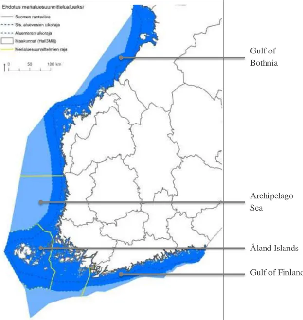
The EEZ will be addressed in the three maritime spatial plans intended for the mainland and the Åland Islands. Plans will be drafted for the EEZ and the territorial waters. The three planning areas are: (1) the Gulf of Finland; (2) the Archipelago Sea and the Southern part of Bothnian Sea; and (3) the Northern Bothnian Sea, Quark and the Bothnian Bay.9 The Åland Islands will produce its own plan.11 The eight coastal regional councils that have territorial waters in their area are responsible for the planning and authorization of maritime spatial plans. Furthermore, the responsible regional councils must plan the maritime spatial plans in cooperation with one another.5 The Regional Council of Varsinais-Suomi coordinates the cooperation.10
The maritime spatial plans have no legal effect and they are not binding. According to the Land Use and Building Act (132/1999), the purpose of the maritime spatial plans is to promote the sustainable development and growth of the various forms of maritime use, the sustainable use of natural resources in the marine environment and the achievement of a good marine environment.8 Furthermore, maritime spatial plans are used to examine the needs of different marine uses and find ways in which to reconcile them. Examined marine uses include energy, transport, fisheries and aquaculture, tourism, recreational use, conservation, the protection and improvement of the environment and nature. Attention must also be paid to the needs of national defence. 8
13
Figure 2. Marine and MSP areas in Finland (Source: MSP in Finland - Plan4Blue, Tallinn, 2017)
Gulf of Bothnia
Archipelago Sea
Åland Islands Gulf of Finland
14
3.2 Estonia
Table updated from VASAB11 Country Fitch and MSP Platform12
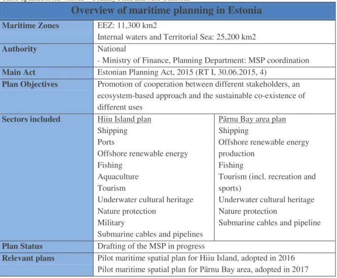
Overview of maritime planning in Estonia
Maritime Zones EEZ: 11,300 km2
Internal waters and Territorial Sea: 25,200 km2
Authority National
- Ministry of Finance, Planning Department: MSP coordination Main Act Estonian Planning Act, 2015 (RT I, 30.06.2015, 4)
Plan Objectives Promotion of cooperation between different stakeholders, an ecosystem-based approach and the sustainable co-existence of different uses
Sectors included Hiiu Island plan Shipping Ports
Offshore renewable energy Fishing
Aquaculture Tourism
Underwater cultural heritage Nature protection
Military
Submarine cables and pipelines
Pärnu Bay area plan Shipping
Offshore renewable energy production
Fishing
Tourism (incl. recreation and sports)
Underwater cultural heritage Nature protection
Submarine cables and pipeline
Plan Status Drafting of the MSP in progress
Relevant plans Pilot maritime spatial plan for Hiiu Island, adopted in 2016 Pilot maritime spatial plan for Pärnu Bay area, adopted in 2017
Before the Directive on Maritime Spatial Planning (2014/89/EU), planning of marine areas in Estonia was based on terrestrial planning, conducted through pilot projects at the county level. Since June 2015, MSP is regulated by the Planning Act (RT I, 30.06.2015, 4). Within the Planning Act par. 14(2), the functions of the MSP have been defined alongside the requirements for the planning process, such as the involvement and the informing of interest groups and the public, the obligation to take into account relevant strategies, risk analyses, existing spatial plans that are in effect, development plans and other documents that have an impact on spatial development.
Following the Planning Act, MSP will be carried out at the country level, as an extension to the national plan, with a clear distinction between terrestrial and maritime spatial planning. A new revised version of the Planning Act that came into force on 01.01.2018 states that spatial plans at all levels (including the national plan and MSP) will be evaluated every 5 years.
15
Legal Frameworks
The planning department of the Ministry of Finance coordinates the MSP process and the Strategic Environmental Assessment (SEA). Planning on land and on the EEZ (in addition to internal waters and territorial sea) is based on the Estonian Planning Act (2015) and order of the Government from 2012. A procurement procedure for the planning and impact assessment consultancy was supposed to be finalized by the end of 2017 and work on developing the plans was set to start in January 2018.
In October 2012, the Government of Estonia initiated two pilot maritime spatial plans – in the area around the Hiiu Island and the Pärnu Bay area, while the national maritime spatial plan for the Estonian marine areas (internal waters, territorial waters and EEZ) was initiated by the Government of Estonia on May 25th, 2017.
The first two pilot MSPs in Estonia were adopted with the aim of being applied to the Hiiumaa Island13 in 2016 and to Pärnu Bay in 2017.14 The planning process regarding the rest of the Estonian marine areas, including both the territorial waters and the EEZ, was initiated with the Order No 157 of the Estonian Government (25.05.2017).
Possible subjects to be covered by MSP are infrastructure (energy, transport), providing a sustainable use of fisheries, taking into account the MPAs and establishing measures for maintaining a healthy environment.
The maritime spatial plan will be a long-term national level plan, which will offer guidelines to the various institutions in charge of allowing the use of marine areas for different purposes, such as offshore energy, shipping, etc. It is expected that the national MSP will be adopted at the end of 2019 or the beginning of 2020 and it will include two pilot MSPs.
The two pilot MSP projects undertaken from 2012 until 2016, differ in terms of the processes and the outcomes of the planning proposals. The main objective of the Hiiu Island15 plan is the definition of the long-term uses of the specific marine area through a public process. Differently, part of the territory pertaining to the pilot pro ect of the Pärnu Bay16 area was initially covered by the BaltSeaPlan17 project. In this case, the legal process for MSP was initiated before the pilot plan; also, the first steps of the planning process, including issues like conflict analysis and the identification of future uses, were already completed beforehand.
16
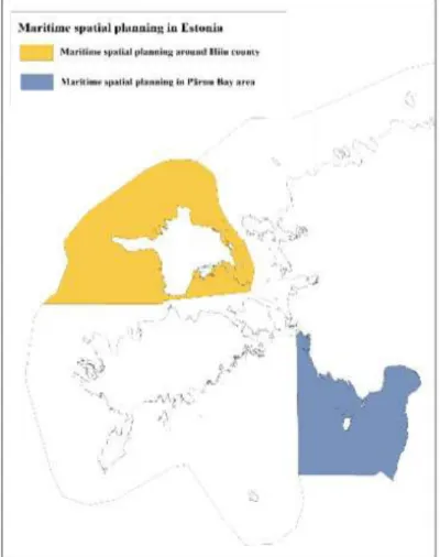
Figure 3. Estonian marine areas and the areas covered by the two pilot MSPs (Source: MSP Platform, Country profile18)
The Pärnu Bay MSP was developed in cooperation with different stakeholders. A balanced use scenario was chosen, featuring a sustainable use of the Pärnu Bayxv area through sustainable fishing, the protection of culturally and naturally important areas, safe shipping routes and diverse recreation possibilities. The map of uses for Pärnu Bay is presented in Figure 4. The Strategic Environmental Assessment (SEA) for this planning process was carried out in a transboundary context, involving Latvia at the early stages of the process. The plan was adopted in April 2017.
17 i r rn a ar a ariti patial plan So rc S lat or o ntr pro ile18)
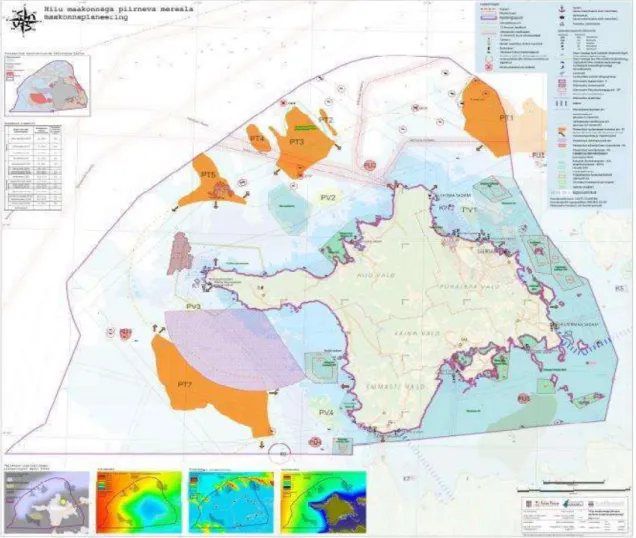
Based on the Estonian Planning Act and an order by the Estonian Government, the plan for Hiiu Island was adopted in October 2012. The main objective of the plan was the definition of the long-term uses of the selected marine area through a public process.
Similar to Parnu Bay, part of the area pertaining to the Hiiu island pilot project was covered by the BaltSeaPlan project. The legal process for the MSP, along with the first steps of the planning process, had started before 2012, the year in which the planning process began. The planning process for the Hiiu Island plan involved public consultation in close cooperation with different national authorities, sectoral stakeholders, and local communities. Considering that Hiiu Island does not have international borders, a transboundary consultation was not arranged. The plan for Hiiu Island was adopted in 2014.
18
Figure 5. Hiiu island MSP, 2016 (source: MSP Platform, Country profile27)
19
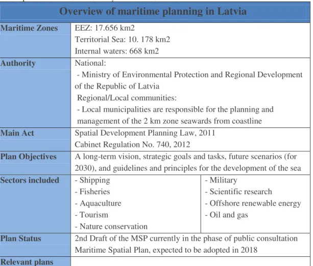
3.3 Latvia
Table updated from VASAB19 Country Fitch and MSP Platform20
Overview of maritime planning in Latvia
Maritime Zones EEZ: 17.656 km2
Territorial Sea: 10. 178 km2 Internal waters: 668 km2 Authority National:
- Ministry of Environmental Protection and Regional Development of the Republic of Latvia
Regional/Local communities:
- Local municipalities are responsible for the planning and management of the 2 km zone seawards from coastline Main Act Spatial Development Planning Law, 2011
Cabinet Regulation No. 740, 2012
Plan Objectives A long-term vision, strategic goals and tasks, future scenarios (for 2030), and guidelines and principles for the development of the sea Sectors included - Shipping
- Fisheries - Aquaculture - Tourism
- Nature conservation
- Military
- Scientific research
- Offshore renewable energy - Oil and gas
Plan Status 2nd Draft of the MSP currently in the phase of public consultation Maritime Spatial Plan, expected to be adopted in 2018
Relevant plans
The work on the legislation was mostly based on a pilot MSP concerning the Latvian waters of the open Baltic Sea, created under the BaltSeaPlan. During the BaltSeaPlan, stakeholder involvement was implemented through several events meant to raise awareness regarding capacity building as based on MSP principles and approaches.21 The establishment of the new Spatial Development Planning Law in Latvia is perceived as being beneficial in terms of an integrated long-term view regarding the entire territory, and for setting priorities and development objectives (spatial structure plan).22 The MSP of Latvia considers all jurisdictional waters (internal waters, terrestrial waters, and EEZ) like the terrestrial parts, functionally interlinked with the sea and coordinating the interests of various sectors and local governments regarding the use of the sea.20 The plan will be a long-term spatial development document (up to 12 years), at a national level, which defines the development objectives and the use of the sea.20 The responsible authority for the Latvian MSP is the Ministry of Environmental Protection and Regional Development of the Republic of Latvia, which has currently released the
20
final MSP draft for public consultation.
The development of the plan started in 2014, after the establishment of a national MSP coordination group and an organised introductory seminar on the national MSP, designed for the general public. The biggest efforts in drafting the Latvian MSP were taken in January 2015-May 2016,23 when the plan was elaborated in tandem with the SEA. The draft of the plan was consulted (in late 2015 and early 2016) in accordance to the national consultations and cross-border consultations within the framework of the Espoo Convention.
The work carried out on the final version of the plan primarily concerned the formulation of a long-term vision, strategic goals and tasks, future scenarios for 2030, and guidelines and principles for the development of Latvia’s sea space. A SEA of the draft plan has also been completed. The plan is expected to be approved by government by the end of 2018.
Figure 6. Conditions for the use of the sea in Latvia (Source: MSP 2030 Summary, 201824)
Legal Frameworks
The development of MSP in Latvia has been based on the Spatial Development Planning Law, issued on the 1st of December, 2011. The authority responsible for the development of the plan is the Ministry of Environmental Protection and Regional
21
Development.
The deadline set by the Planning Law for starting the process of MSP was January 1st, 2014. The law also required that plan be submitted and announced through the usual legislative procedures and that it be approved by the government. A regulation by the Ministers’ Cabinet on Development, Implementation and Monitoring of a Maritime Spatial Plan was approved in 2012. It outlines and defines procedures as well as the implementation and monitoring procedures of MSP.
In terms of planning on a regional level, several coastal regional strategies exist and they are focused on terrestrial areas. Land-Sea interaction and ICZM have been implemented in the strategies of two regions which border the sea. Local municipalities act as a main regional authority and can plan coastal water areas under the terrestrial plans, specifically regarding the issues related to recreational development. According to the Land Management Law, local municipalities are allowed to plan sea areas extending to 2km seaward.
22
3.4 Lithuania
Table updated from VASAB25 Country Fitch and MSP Platform26
Overview of the maritime planning in Latvia
Maritime Zones EEZ: 4,560 km2
Territorial Sea: 1,845 km2
Internal waters: to the baseline, lagoons not included, about 35 km2
Authority National
Ministry of the Environment: Territorial Planning, Urban Development and Architecture Department; Spatial Planning Division
Main Act National
- MSP is included in the Law on Territorial Planning and its secondary legal acts, 2014
- 20 legal Acts - laws and governmental resolutions guiding the use of sea space
- The UNCLOS which specifies sectoral laws, implemented for EEZ
- Law of the Coastal Strip (up to 20 m isobaths)
Plan Objectives A transparent plan which provides knowledge of the use regarding marine areas and the territory as whole. (Integrated terrestrial planning of the land and sea space pertaining to the territory of Lithuania.)
Sectors included - Shipping - Ports - Fisheries - Tourism - UCH
- Nature conservation - Oil and gas usage - Submariner cables - Mineral extractions - Offshore renewable energy Plan Status A comprehensive Plan of the Republic of Lithuania, adopted
in 2014(currently being updated as a new revision of Lithuanian Comprehensive Plan)
Relevant plans Not legally binding:
The Pilot MSP developed within BaltSeaPlan resulted in a statutory MSP process.
- BaltSeaPlan Findings (2009-2012): MSP Pilot project i.a. in the Lithuanian Sea – guidelines, stakeholder involvement - PartiSEApate (2012-2014): Pilot case area i.a. the Lithuanian Sea with Lithuania, Latvia, Sweden and Russia
23
The MSP of Lithuania was adopted on June 11th 2015 by the Parliament of the Republic of Lithuania, Resolution No XII-1781, as a binding Comprehensive Plan of the Territory of the Republic of Lithuania, supplemented by solutions regarding marine space. It was established as a national plan according to Art. 47 of the Constitution of the Republic of Lithuania and states that the exclusive right regarding Lithuanian maritime space belongs to the Republic of Lithuania (i.e. owned by the state).26 The MSP of Lithuania includes the extension of the planning of marine territories implemented under the Comprehensive Plan of the Territory of the Republic of Lithuania on marine territories (territorial waters and the EEZ), where marine spatial solutions were introduced. Thus, the MSP of Lithuania applies to the entire marine area, including territorial waters and the exclusive economic zone (EEZ).
The objective of the MSP of Lithuania is to ensure the transparent, known-in-advance conditions regarding the use of the territory of the entire state and the space under the responsibility of the Republic of Lithuania and to formulate a resultant document containing both planning of land and sea.
During the planning process, a complete SEA for MSP was elaborated. Both the MSP and SEA processes included national and cross-boundary consultations with Lithuanian stakeholders as well as with ones from Sweden and Latvia. During all the stages of the planning process, the information was made public and the materials of the plan were publicly available on the webpage of the Planning organizer – the Ministry of Environment. Also, the MSP was publically presented during national and international conferences and specific public hearings were organized with the aim of informing the public.26
Legal Frameworks
The Comprehensive Plan of the Republic of Lithuania, inclusive of a part specifically on “Maritime Territories” is a legally binding document adopted by its Parliament (Seimas) in 2015. The purpose of the Comprehensive Plan is to confirm existing human uses of the entire country as well as to implement the planning of land and sea space within one document.
The MSP in Lithuania is included in the national legislation that regulates spatial planning under the Law on Territorial Planning, revised in 2013 to include a requirement for marine space planning. The marine space (up to 20 m of isobaths) also falls under the regulation of the Law of the Coastal Strip. Basing on stipulations of national legal acts, Lithuanian marine territories were planned via extending the existing Comprehensive Plan of the Territory of the Republic of Lithuania by one more part entitled“Marine Territories,” which included marine spatial solutions for the Lithuanian territorial waters and the EEZ.25, 26
24 Figure 7. Marine uses under the MSP of Lithuania (Source: MSP Platform, Country profile26)
25
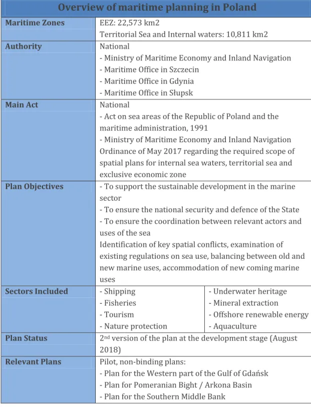
3.5 Poland
Table updated from the 2nd Polish MSP Consulting Meeting27, VASAB28 Country Fitch and MSP Platform29
Overview of maritime planning in Poland
Maritime Zones EEZ: 22,573 km2
Territorial Sea and Internal waters: 10,811 km2 Authority National
- Ministry of Maritime Economy and Inland Navigation - Maritime Office in Szczecin
- Maritime Office in Gdynia - Maritime Office in Słupsk
Main Act National
- Act on sea areas of the Republic of Poland and the maritime administration, 1991
- Ministry of Maritime Economy and Inland Navigation Ordinance of May 2017 regarding the required scope of spatial plans for internal sea waters, territorial sea and exclusive economic zone
Plan Objectives - To support the sustainable development in the marine sector
- To ensure the national security and defence of the State - To ensure the coordination between relevant actors and uses of the sea
Identification of key spatial conflicts, examination of existing regulations on sea use, balancing between old and new marine uses, accommodation of new coming marine uses
Sectors Included - Shipping - Fisheries - Tourism
- Nature protection
- Underwater heritage - Mineral extraction
- Offshore renewable energy - Aquaculture
Plan Status 2nd version of the plan at the development stage (August 2018)
Relevant Plans Pilot, non-binding plans:
- Plan for the estern part of the ulf of dan sk - Plan for Pomeranian Bight / Arkona Basin - Plan for the Southern Middle Bank
26
Poland is quite experienced in the planning of marine space through the development of three non-binding pilot plans. These three plans are:
1. The pilot maritime spatial plan for the estern part of the Gulf of Gda sk30 which prioritizes certain uses, as well as formulates general requirements and details use restrictions.
2. The pilot maritime spatial plan for the Pomeranian Bight/Arkona Basin31 which prioritizes certain sea uses, and formulates general recommendations while also excluding certain users from some areas.
3. The pilot maritime spatial plan for the Southern Middle Bank32 which is a strategic plan of the cross border area, prioritizing certain sea uses, and formulating general recommendations, requirements and prohibitions (limitations/prohibitions introduced only in four cases). It covers 1751.5 km2 of EEZ of Poland and Sweden.
The preparation of a legally binding maritime plan for all Polish sea areas (including internal waters, territorial sea and EE ), with the exception of the internal port and lagoon waters (the Szczecin, amie ski and Vistula Lagoons), began in March of 2014. A coherent plan for Polish waters has been coordinated by the Director of the Maritime Office in Gdynia, on behalf of the Directors of Maritime Offices in Szczecin, Słupsk and Gdynia. Throughout the development of the plan, SEA procedure has been employed.
The first stage of this process, “Study of the Conditions of Spatial Development of Polish Sea Areas,” was completed in February of 2015.28
Poland has developed several draft versions of the national Maritime Plan, under the legal provision for the planning of internal waters, territorial sea and EE . The “zero version” (May 2017) delimited the key sea basins as well as assigned them priority and secondary functions. It also identified key spatial conflicts and examined existing regulations regarding the use of sea areas. The map of sea uses for Polish maritime areas, according to the zero version, is presented in Figure 8. The zero draft of the plan, which covers the delimitation of sea areas as well as their basic and other permitted functions, was carefully consulted by different stakeholders. Some of the topics under discussion included concrete problems such as navigation or fishing in offshore wind farms.
In June of 2018, “version one” of the MSP plan was released for consultation. This version defines the sea basins and sub-basins, sets the prohibitions or limitations on their use by taking into account the needs of nature conservation, indicates the distribution of investments of public interest, describes the direction that the development of transport and technical infrastructure should take, as well as outlines the
27
conditions for the protection of the environment, cultural heritage, fishery, aquaculture, renewable energy and the exploration and extraction of minerals.
The first draft was displayed at public hearings on the 19th of June, 2018.33 Along with this draft, a SEA report was also presented at these public hearings. The plan was prepared in collaboration with the team responsible for the SEA report.
Simultaneous transnational consultations took place from the very beginning. The draft plan was subject to transboundary consultations, according to the VASAB-HELCOM guidelines on transboundary consultations, public participation and co-operation.34
Figure 8. MSP for the Polish sea area, zero version (Source: Maritime Office in Gdynia, 201834)
Legal Frameworks
The main legal act regarding maritime spatial planning is the “Act on sea areas of the Republic of Poland and the maritime administration” of March 21st, 1991, which regulates the planning of sea space. The plan was amended in 2015 in order to implement Directive 2014/89/EU. The supporting law to the former is the “Ministry of Maritime Economy and Inland Navigation Ordinance” of May 17th, 2017. A significant role, as it regards MSP, is also played by the “Act on access to information on
28
environment and its protection, public participation in environmental protection and on environmental impact assessment,” which stipulates that all spatial plans are sub ect to the SEA procedure. The same stipulation is repeated in the law on MSP.
An MSP will be adopted via ministerial regulation, by the Minister responsible for maritime economy and the Minister responsible for construction, spatial planning and development, in consultation with the Ministers responsible for environment, water management, culture and national heritage, agriculture, fisheries, transport, internal affairs and the Minister of National Defence.
29
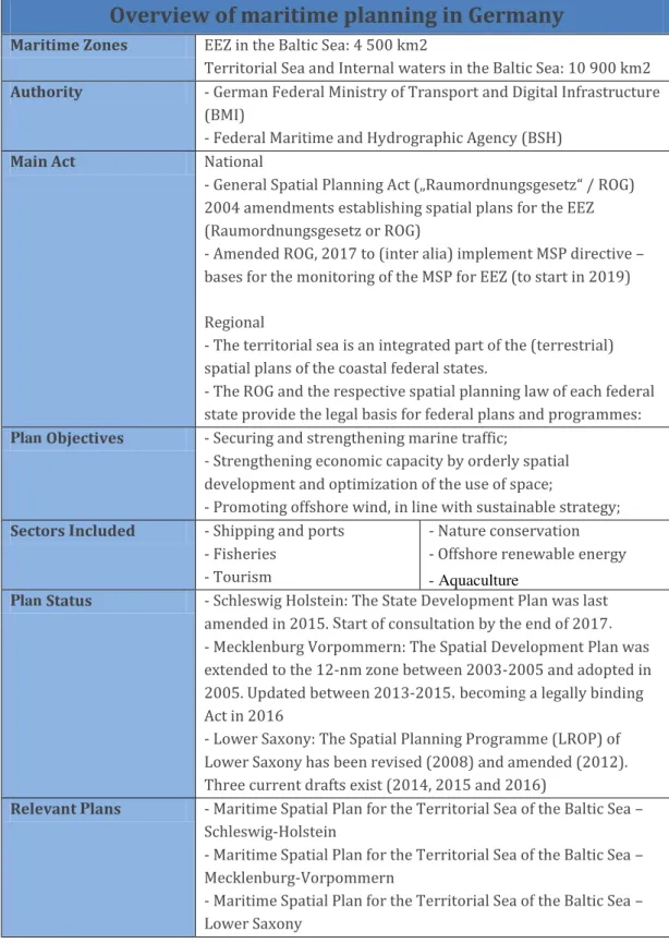
3.6 Germany
Table updated from VASAB35 Country Fitch and MSP Platform36
Overview of maritime planning in Germany
Maritime Zones EEZ in the Baltic Sea: 4 500 km2
Territorial Sea and Internal waters in the Baltic Sea: 10 900 km2 Authority - German Federal Ministry of Transport and Digital Infrastructure
(BMI)
- Federal Maritime and Hydrographic Agency (BSH)
Main Act National
- eneral Spatial Planning Act „Raumordnungsgesetz“ / RO 2004 amendments establishing spatial plans for the EEZ (Raumordnungsgesetz or ROG)
- Amended ROG, 2017 to (inter alia) implement MSP directive – bases for the monitoring of the MSP for EEZ (to start in 2019)
Regional
- The territorial sea is an integrated part of the (terrestrial) spatial plans of the coastal federal states.
- The ROG and the respective spatial planning law of each federal state provide the legal basis for federal plans and programmes:
Plan Objectives - Securing and strengthening marine traffic;
- Strengthening economic capacity by orderly spatial development and optimization of the use of space;
- Promoting offshore wind, in line with sustainable strategy;
Sectors Included - Shipping and ports - Fisheries
- Tourism
- Nature conservation - Offshore renewable energy - Aquaculture
Plan Status - Schleswig Holstein: The State Development Plan was last amended in 2015. Start of consultation by the end of 2017.
- Mecklenburg Vorpommern: The Spatial Development Plan was extended to the 12-nm zone between 2003-2005 and adopted in 2005. Updated between 2013-2015, becoming a legally binding Act in 2016
- Lower Saxony: The Spatial Planning Programme (LROP) of Lower Saxony has been revised (2008) and amended (2012).
Three current drafts exist (2014, 2015 and 2016)
Relevant Plans - Maritime Spatial Plan for the Territorial Sea of the Baltic Sea – Schleswig-Holstein
- Maritime Spatial Plan for the Territorial Sea of the Baltic Sea – Mecklenburg-Vorpommern
- Maritime Spatial Plan for the Territorial Sea of the Baltic Sea – Lower Saxony
30
An exception in the Baltic region, Germany has MSP implemented only for the EEZ.
The division of the planning areas of German waters is included in the EEZ for federal jurisdiction and three coastal states plans, covering ICZM and territorial waters.37
In regard to the MSP Directive – a request for the trans boundary consultation, coordination, and consideration of land-sea interaction and EBA – the national Spatial Planning Act was revised and implemented in 2016. 36 In 2018, the revision process of a second MSP for the EEZ of the Baltic, has begun, with a draft planned to be released for consultation in 2019. The 2nd plan is foreseen for 2021. 36
Toward the preparation of the 2nd MSP, German authorities (e.g. BSH) have obtained lessons learned through an active engagement in the vast number of regional sea projects (e.g. Interreg BaltSeaPlan and PartiSEApate, EC project Baltic SCOPE) and as Lead Partner in the Interreg projects of NorthSEE and Baltic LINes. BMI/BSH are members in the informal working group, set up by the European Commission, to discuss all aspects of the implementation of the MSP directive. The “Guiding principles and strategies for the spatial development in Germany” are currently under revision. The guidelines include a separate chapter concerning the sustainable use of coastal and marine areas. In line with the MSP Directive requirements on the cross-border coherence of MSP, the Federal Spatial Planning Law is currently under revision in order to become better aligned with the Directive.
The currently used MSP in the German EEZ for the Baltic Sea is based on a set of guidelines which include the securing and strengthening of marine traffic, the promotion of offshore wind energy, the strengthening of economic capacity through spatial development, the optimization of the use of space, as well as the protection of natural resources by avoiding disruptions to and pollution of the marine environment. In order to co-ordinate the growing conflicts of maritime uses, in particular between the space required by offshore wind farms and marine environmental protection goals as well as traditional maritime uses such as shipping and fisheries, an integrative and sustainable approach was developed for the German EEZ.
31 Figure 9. Maritime uses in the German Baltic Sea (Source: MSP Platform, Country profile36)
Legal Frameworks
MSP in Germany is based on the Federal Land Use Planning Act that was extended to the exclusive economic zone. Spatial plans for the territorial sea (up to 12 nm) are developed by the German Länder (Federal States). The federal states in Germany are responsible for the implementation of Natura 2000 on land and in coastal waters, within the 12 nm zone. In the EEZ, such responsibility is given to the federal government, represented by the Federal Ministry of Environment, Nature Conservation and Nuclear Safety (BMU) and the Federal Nature Conservation Agency (BfN). xxxvi So far, after the adoption of the MSP in EEZ, the BfN has developed a plan to identify areas of special importance for nature conservation. The German marine research institutions carry out comprehensive research projects for the identification, designation and nomination of the Natura 2000 sites in the German EEZ. Such projects are done under the framework of a special research programme supported by the BfN and the BMU. The main focus of the research was on the collection of data regarding the distribution and the population sizes of protected species.36
Planning on the national level is based on the Spatial Planning Act (ROG) from 2004, applicable to the EEZ of Germany. In terms of regional planning, territorial sea is
32
considered an integrated part of the terrestrial planning of the coastal states (Schleswig Holstein, Mecklenburg Vorpommern, Lower Saxony). An important piece of legislation, however, is the ROG and the respective spatial planning law of each federal state, which provide the legal basis for federal plans and programmes.
A list of the legislations for planning on the national and regional levels is provided in the overview table of this chapter.
3.7 Denmark
Table updated from VASAB38 Country Fitch and MSP Platform39
Overview of maritime planning in Denmark (Baltic)
Maritime Zones EEZ: 61 500 km2
Territorial Sea: 40 000km2 Internal waters: 3 500 km2
Authority Danish Maritime Authority, Ministry of Business and Growth.
Main Act Act on Maritime Spatial Planning, 2016 Plan Objectives - Integration between activities
- Concern about economic growth - New and emerging uses of marine area;
Sectors included - Shipping - Fisheries - Tourism - Military
- Mineral extraction
- Offshore renewable energy - Aquaculture
- Nature conservation - Oil and gas
- Submarine cable and pipelines
Plan Status Under development. First consultation planned by mid- 2019
Relevant plans
Denmark is in the early stages of drafting its first MSP, with the plan consultation planned for mid-2019.40 Marine activities are currently managed through a number of sectorial acts and plans (e.g. Act on marine environmental protection, energy supply, fisheries, raw material, subsoil, continental shelf, harbour, safety at sea). These sectoral plans will be included in the new maritime spatial plan which will apply to marine internal waters, territorial sea, and the EEZ. The Danish sea, the EEZ as well as the territorial waters, belong to the public and are managed by the Government.
33 Figure 10. Maritime areas of Denmark (Source: IOC-UNESCO41)
Legal Frameworks
The main Act for the MSP in Denmark is the “Act on Maritime Spatial Planning, 2016,”
adopted by the Danish Parliament. The purpose of the Act is to promote economic growth, the development of marine areas and the use of marine resources on a sustainable basis. The Act aims to contribute to the achievement of goals regarding maritime spatial planning while also taking into account land-sea interaction and strengthening cross-border cooperation.42
The sectors to be included in the future maritime spatial plan include: the energy sector, maritime transport, fishing and aquaculture, the extraction of raw materials and the preservation, protection and improvement of the environment, including resilience in the face of the consequences of climate change. Military activities, cultural heritage, and municipal plans for use of coastal waters, among others, will not be regulated by the plan but the plan will take them into account. Economic growth is a key objective in the maritime spatial planning of the Danish marine waters.39
The Danish Maritime Authority (DMA) has been identified as the national MSP authority and, on January 1stof 2017, the DMA began generating Denmark’s first national maritime spatial plan.
34
3.8 Sweden
Table updated from VASAB43 Country Fitch and MSP Platform44
Overview of maritime planning in Sweden
Maritime Zones EEZ: 60 000 km2
Territorial Sea: 70 000km2
Authority Swedish Agency for Marine and Water Management Main Act - The Swedish Environmental Code
- Plan and Building Act
Plan Objectives Need for a more integrated approach;
Economic growth concerns;
Perceived conflicts among uses;
Perceived conflicts between uses and nature conservation;
Marine conservation or biodiversity concerns;
New and emerging uses of the marine area Sectors included - Shipping
- Fisheries - Tourism - UCH
- Military
- Offshore renewable energy - Aquaculture
- Nature conservation Plan Status National – Planning underway for planning phase: 2015-
2019
Relevant Plans Municipality – few existing
Currently, in Sweden, there is no national marine spatial plan covering the territorial sea and the EEZ. However, three plans, covering the territorial sea and the EEZ, are under preparation: Skagerrak/Kattegat, Baltic Sea and Gulf of Bothnia. On December 1, 2016, SwAM45 published an early draft of MSP proposals for all three national MSP areas. On January/February of 2017, environmental impact assessments (within the SEA- processes) were published. The drafts and the EIA are the basis for a broad dialogue with trade organisations, NGOs, central government agencies, regional government bodies (County Administrative Boards), regions, municipalities, academia and neighbouring countries.
35 Figure 11. Marine areas of Sweden (Source: SWAM46)
The following maps (Figures 12-14) present the uses in each of the sub-national MSPs.
The presented uses have been deemed to be the most suitable and take precedence over other uses. Therefore, all other use in the area should adapt to the conditions and needs of the uses shown.47, 48, 49
Where more than one use is shown, coexistence has been considered possible. In addition, the possibility of the co-existence of different uses (Multi-Use combinations) has been presented within the sub-national marine plans in Sweden. However, the following uses are exceptions form other marine uses and cannot be interrupted. This rule applies to each of the three plans: the laying, operation, and maintenance of data and telecommunication cables, power cables, pipelines, and gas lines must be made possible where appropriate. 47, 48, 49
In contrast to the other national MSPs, in Sweden’s plan, a multi-sectoral cooperation among the defence and energy sectors has been introduced. Although OWE can be seen as an obstacle to defence activities, favourable conditions for their coexistence in several locations were determined, particularly in the possibility of technical developments in both the energy and the defence sectors.
Bothnian Sea
Baltic Sea
Skagerrak and Kattegat
36
The proposed uses of the three sub-areas of Swedish waters have been introduced by SWAM, and are presented below, in Figures 12-14.
Figure 12. Proposal for the MSP of Gulf of Bothnia (Source: SWAM47)
37 Figure 13. Proposal for the MSP of Gulf of Skagerrak and Kattegat (Source: SWAM48)
38
Figure 14. Proposal for the MSP of the Baltic Sea (Source: SWAM49)
Legal Frameworks
The Swedish Environmental Code (EC, 1998:808) and the Plan and Building Act (2010:900) constitute the legal basis for MSP in Sweden. According to the Environmental Code, three marine spatial plans have been developed in Sweden including the MSP for Bothnian Bay, Baltic Sea, and Western Waters (Skagerrak/Kattegatt). The plans include marine areas in the one nautical mile from the baseline seawards and EEZ. The plans, which shall be adopted by the Government, shall be guiding and contributing to sustainable development. The Government may, according to legislation, adopt regulations prohibiting or limiting activities in the specific geographical areas.
The MSP process is regulated by the MSP Ordinance, which contains the following provisions regarding geographical boundaries: the content of the marine spatial plans, the responsibility for plan preparation, consultation and cooperation throughout the proposal process, as well as monitoring and review. Simultaneously, the Plan and Building Act regulates the responsibilities and mandates of the municipalities responsible for land and water planning, including the territorial sea.